Agasthya
A newsletter on the Natural History, Ecology
and Conservation of the Agasthyamalai region, Western Ghats, India.
Any and all opinions expressed in this newsletter are solely those of the author(s) and do not reflect the opinion of ATREE.
Centre for Excellence in Conservation Science
Royal Enclave,Srirampura,Jakkur Post
Bangalore-560064
Telephone: 080-23635555 (EPABX)
Fax : 080- 23530070
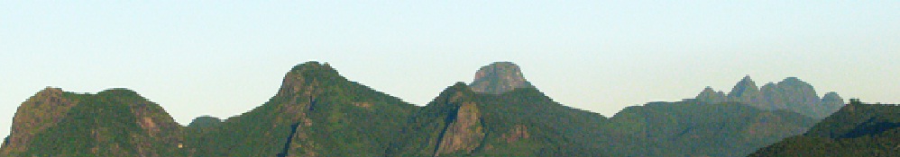
Only by removing the filter of administrative boundary between Tirunelveli and Thoothukudi districts can one visualize the seamless linkages between diverse & varied natural elements viz. forest clad mountains, toddy palm dotted arid lands, riparian habitats, ponds and lakes of different sizes embedded within the sprawling agricultural fields, and swamps among the red sand dunes. Perhaps for a better biodiversity conservation planning and execution, this varied human-nature interface along with the natural forests of the Western Ghats should be considered as a single conservation complex.
Here the Tamirabarani forms the lifeline, providing silt rich water for irrigation and potable water for quenching the thirst of millions of parched throats. Its tributaries originating from different parts of the Agasthyamalai mountain ranges ensures a seasonally staggered drainage owing mainly to staggered monsoons in different regions of the mountain slopes. This renders the rivers and its associated biodiversity and agriculture a distinct perennial characteristic in the otherwise seasonal drainage pattern of the dry landscape.
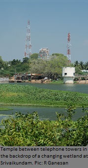
The past administrators, with good foresight, constructed many ponds interconnected through a network of canals to the Tamirabarani and its tributaries. Recent infrastructure growth and development however have grossly violated this ancient wisdom, destroying many of these vital canals and ponds to accommodate human habitations, rendering the fertile land uncultivable. The majestic temple towers, steeples of churches and domes of mosques that reflected the rich heritage of the past are now obscured by the towering apartments, windmills and telephone towers. The irrigation canals criss-crossing the Tirunelveli city that were lined with bathing ghats from the past have now become dump yards of waste being lined with stones or covered with slabs- the signature of development and in the process severely depleting its plant and bird abundance and diversity.
Understanding that the network of Tamiraparani and its tributaries, canals and ponds are the umbilical cords of millions of humans and diverse life forms, and its intimate association with Agasthyamalai, the mother of both Tirunelveli and Thoothukudi districts, is the key to conserve the life forms in this landscape.
Editorial Team
Editor: Allwin Jesudasan
Associate editor: Rajkamal Goswami
Editorial Review: R. Ganesan, M. Soubadra Devy, T. Ganesh
Design and presentation: Kiran Salegame
A S H O K A T R U S T F O R R E S E A R C H I N E C O L O G Y A N D T H E E N V I R O N M E N T
Changing landscapes and future of water sources
-R Ganesan
If you have any suggestions or comments please let us know through the boxes below